Current Research - Vegetation Phenology Response to A Changing Climate
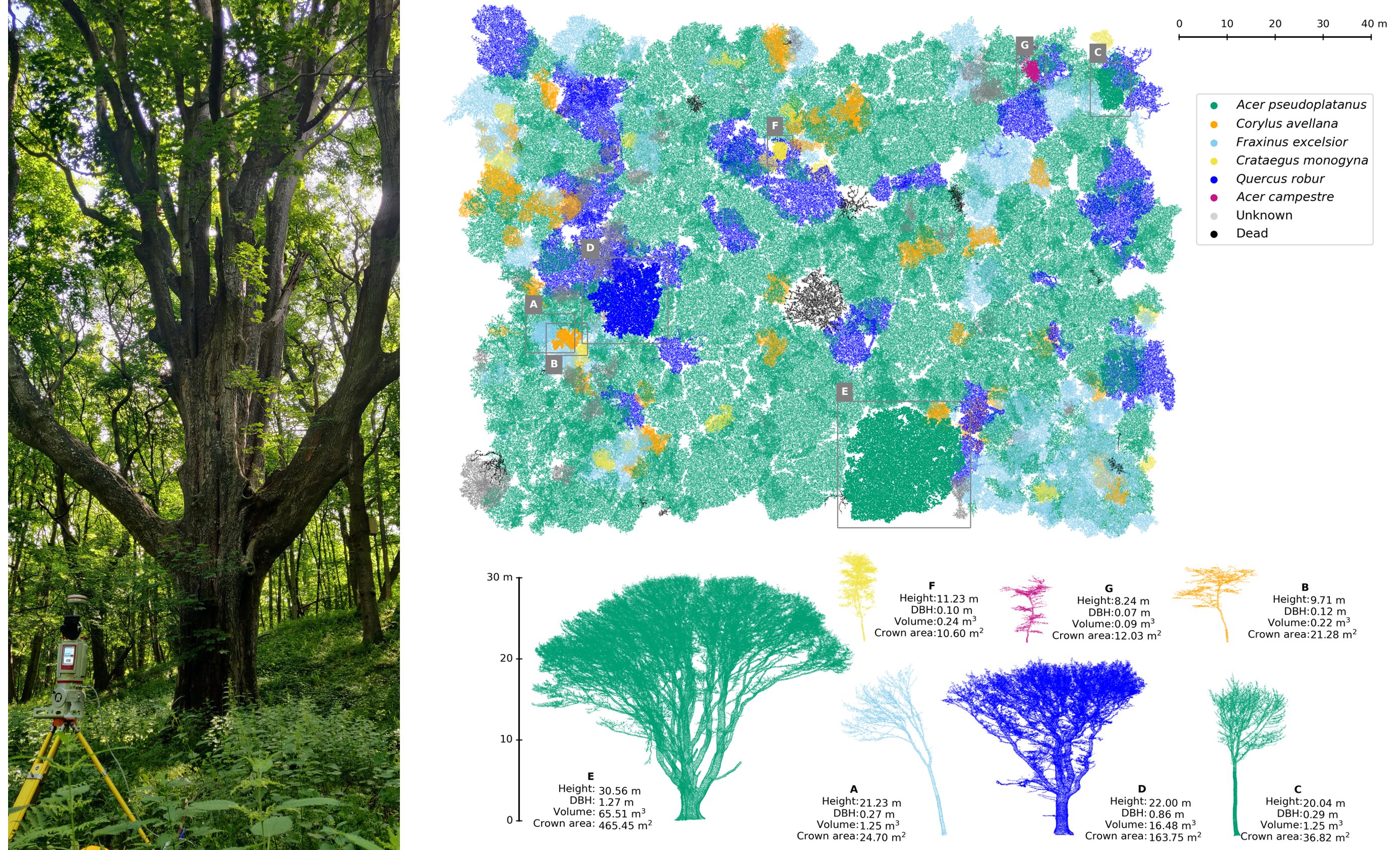
Questions I’m thinking about…
- How to investigate the phenology response to a changing climate over various tree species at landscape scales?
- How to investigate the interactions among various tree species at landscape scales?
- How to carry out experiments to estimate the carbon dioxide uptake with consideration of tree structure at landscape scales?
Current Research - Downscaling of Satellite-derived Soil Moisture
Questions I’m thinking about…
- How to get soil moisture data of high spatial-temporal resolution at landscape scales?
- How to develop an ecologically-constrained machine learning framework for downscaling satellite-derived soil moisture?
- How to conduct the assessment of downscaled satellite-derived moisture without reference?
- How to investigate the interactions between spatial-temporal change of soil moisture and vegetation phenology and carbon dioxide flux?
Past Research - Radiometric Correction of Forest Multispectral Airborne Laser Scanning Point Clouds
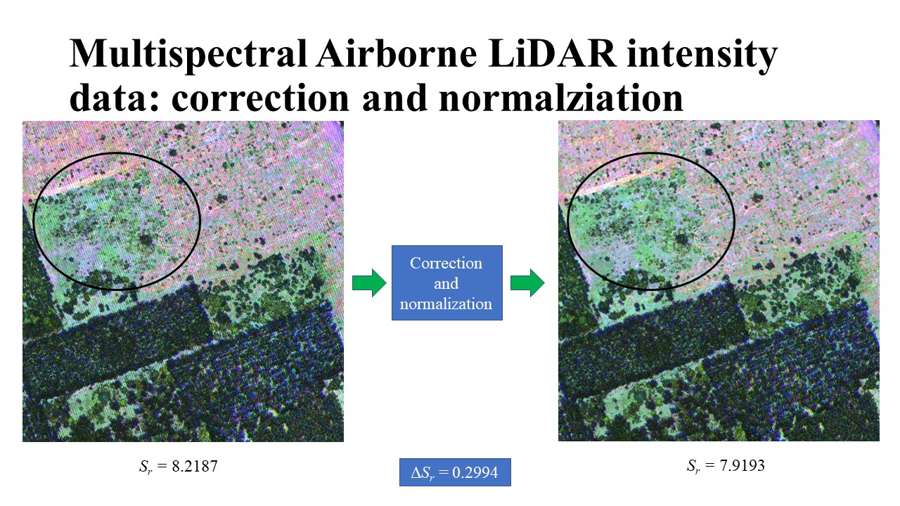
Collaborator: Dr. Yan Wai Yeung
The research goals were to remove stripe artifacts on forest multispectral airborne laser scanning point clouds and to quantify the quality improvement
I defined Boltzmann entropy difference to quantify the quality improvement. Thereafter, I proposed a scale-driven framework to link quality improvement to segementation results
I have been preparing a reserach article with Dr. Yan since 2022. Please stay tuned. The final article will be submitted to ISPRS Journal of Photogrammetry and Remote Sensing at the end of April 2023.
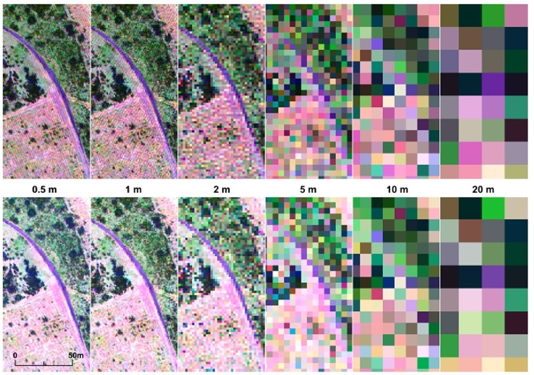
Courtesy: Dr. Yan
Past Research - Determination of the Optimal Number of Clusters
With: Dr. Qiliang Liu at Centralsouth Univ, China
Scientific Questions:
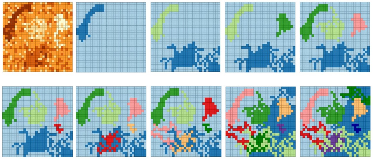
For a given data set, how can we determine its optimal number of classes by clustering (i.e.,Unsupervised Learning)?
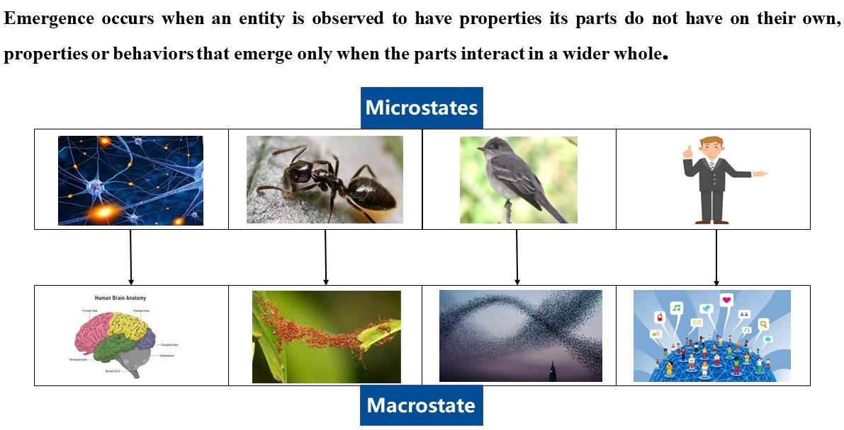
How to understand the information flow from microstates to a macrostate?
Hypotheses:
the clustering process is a kind of emergence representation
I am working with Dr.Liu. We believe the theoretical work is meaningful. Based on such work, I will develop a multi-objetive optimization approach for Blending Landsat and MODIS reflectance for vegetation phenology monitoring.
Past Research - Modeling Information Flow from Remote Sensing Images to Land Use and Land Cover Maps

Advisor: Dr. Zhi-lin Li
Scientific questions
How to understand the mechanism of multispectral remote sensing image classification?
How to understand the information flow and transformation during the classification process?
How to model the information flow and transformation?
Hypotheses:
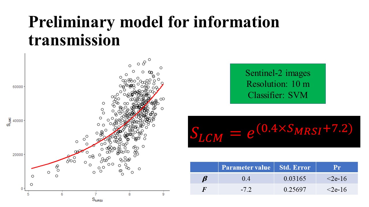
There is a kind of nonlinear relationship between information of multisepctral imagery and land use and land cover maps
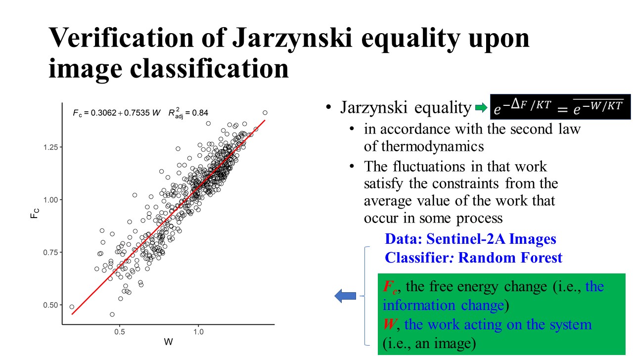
The information flow from multispectral imagery to land use and land cover maps is consistent with the first law of thermodynamics
The verification of those hypotheses is challenging because well-established theories are unavailiable.I modeled the image classification process as a kind of irreversible process where the work acting by a classifier converts an image(numerical data) to a map(nominal data) with given classes. Furtheremore, I proposed a mathematical formula for the information flow with such parameters as Boltzmann entropy of Multispectral images, Boltzmann entropy of land use and land cover maps, classification accuracy, and the total number of classes. Moreover, I proposed an index for the variation of information flow with Crook's Fluctuation Theorem.
I submitted a research article to Remote Sensing of Environment on 14 March 2023. A previous version can be found here. Another paper is expected to be submitted to a remote sensing journal in early/mid April 2023.
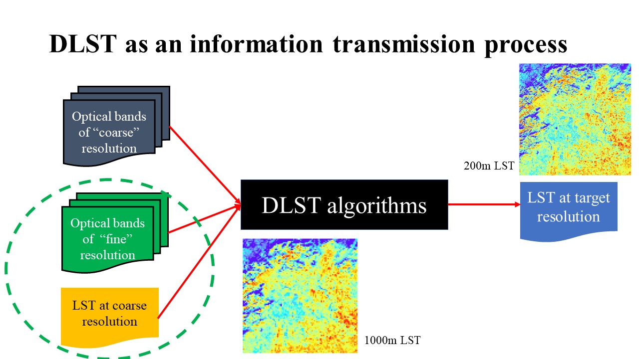
Past Research - No-reference Assessment of Disaggergation of Satellite-derived Land Surface Temperature
Notes: this project is completely led by me.
Scientific questions
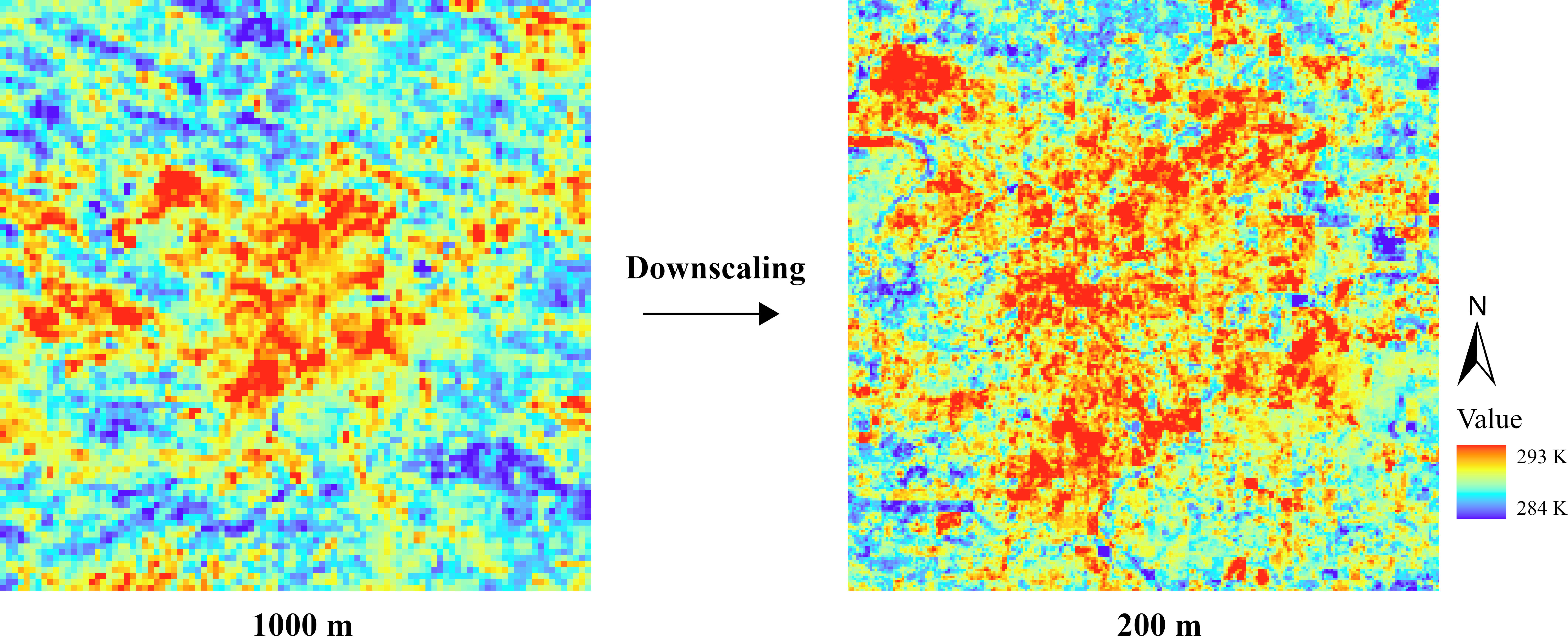
How to assess the quality of downscaled land surface temperature with the absence of reference?
A hypothesis:
The energy per pixel unit remains constant
Past Research - Modelling the Information Fusion in the Blending of the Landsat and MODIS Surface Reflectance
Notes: I conceived all research ideas
Scientific questions
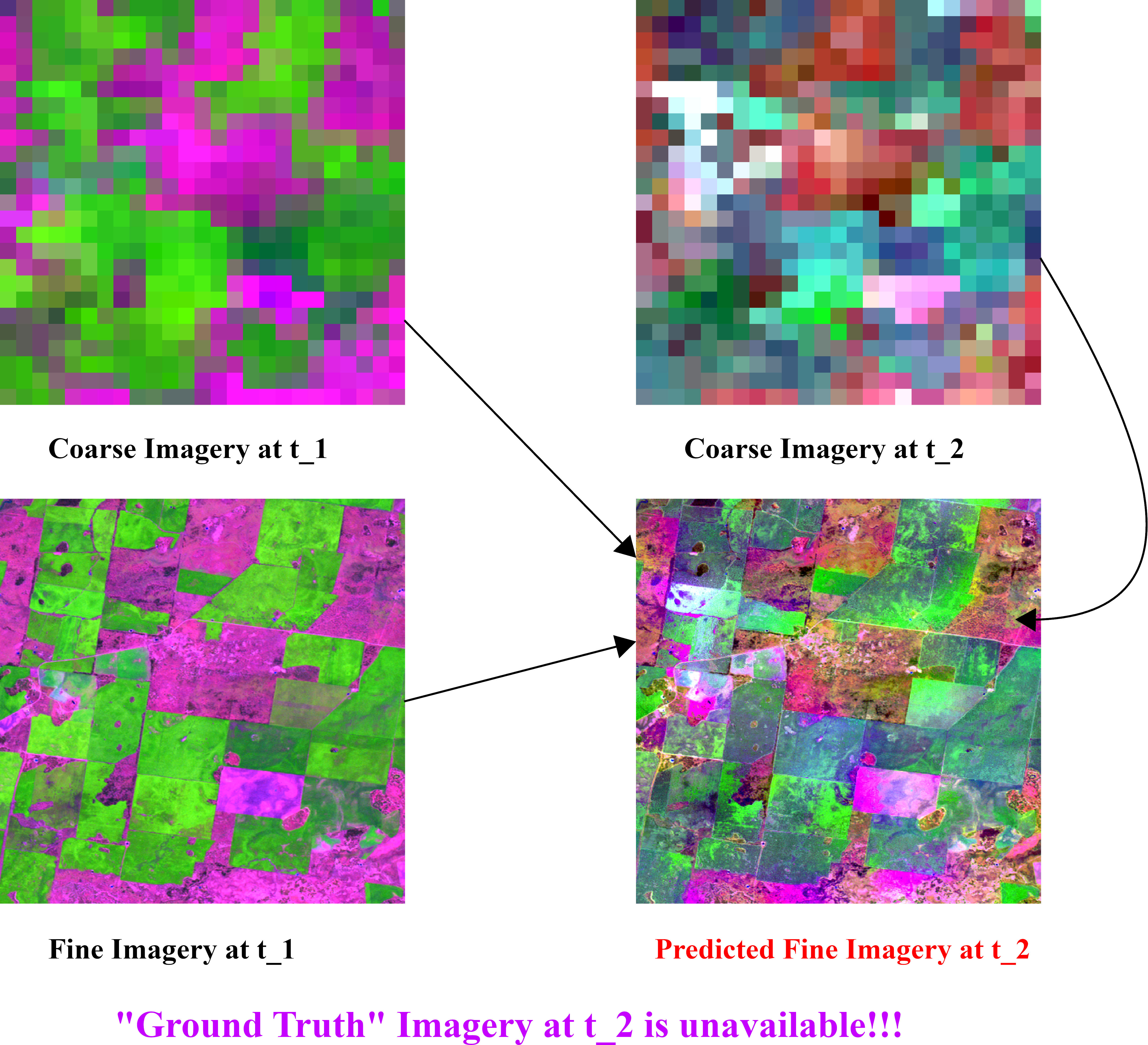
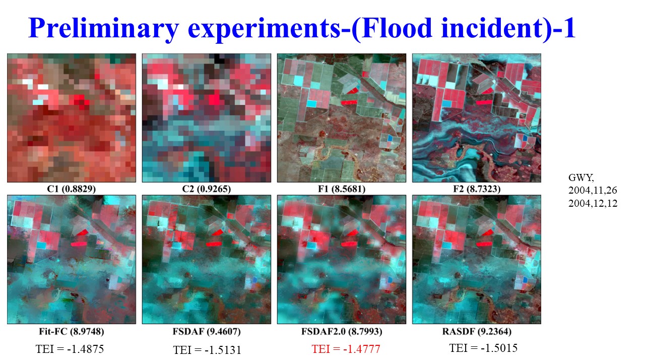
How to understand the process of spatial-temporal fusion of remote sensing images?
How to model the information fusion in the blending of the Landsat and MODIS surface reflectance?
How can we conduct no-reference assessment?
How can we predict the upper and lower limits of spatial-temporal fusion of remote sensing images?
How can we determine the upper and lower bounds of the resolution ratio of coarse and fine images?
Hypotheses:
The total amount of information content will not be changed
There is a kind of nonlinear relationship between information change and the resolution ratio of coarse and fine images
Past Funded Research Project-Development of Boltzmann-entropy-based approaches for remote sensing image analysis
Notes: I did research with the funding from 2020 to Aug 2021. The project was finished last year, a final report of which can be found here
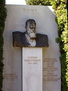
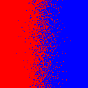
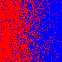
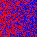
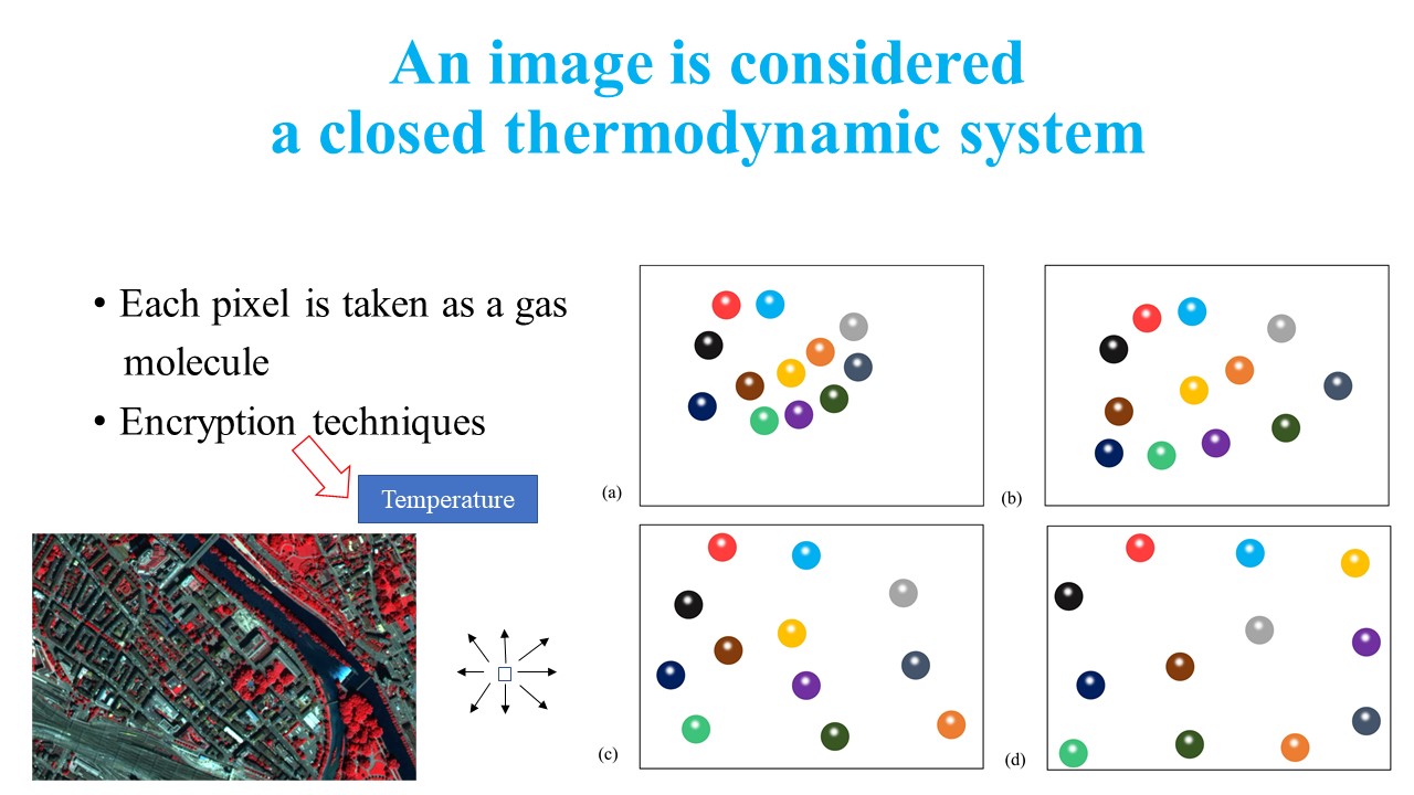
The first column shows the Boltzmann entropy (Thermodynamic entropy, S) formula: S = KlogW; Columns 2-4 show the configurations of mixing gas molecules (i.e., image pixels) by a kinetic theory-based approach
I communicated with Dr. Cushman who is a research scientist at USFS in order to complete projects about thermodynamics in landscape modelling
Dr. Cushman published an article regarding Entropy in Landscape Ecology and the Potential of Thermodynamics.
Python-based package for calculating Boltzmann entropy of numerical and nominal data organized in raster format is released. You can download it from here
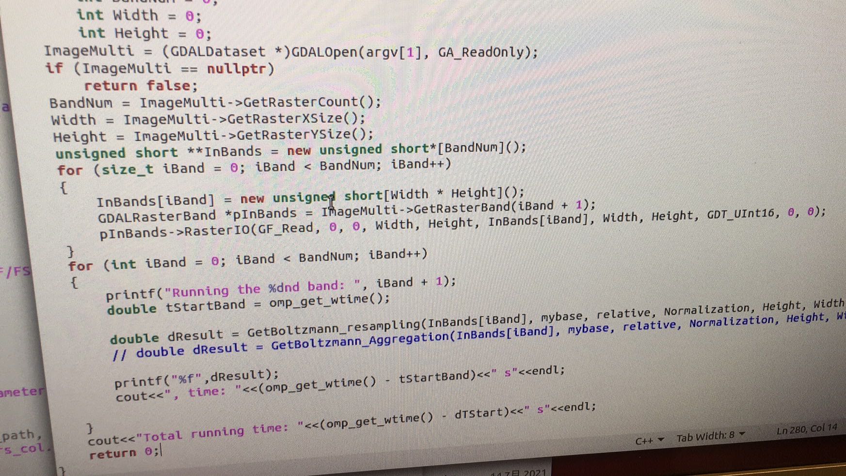
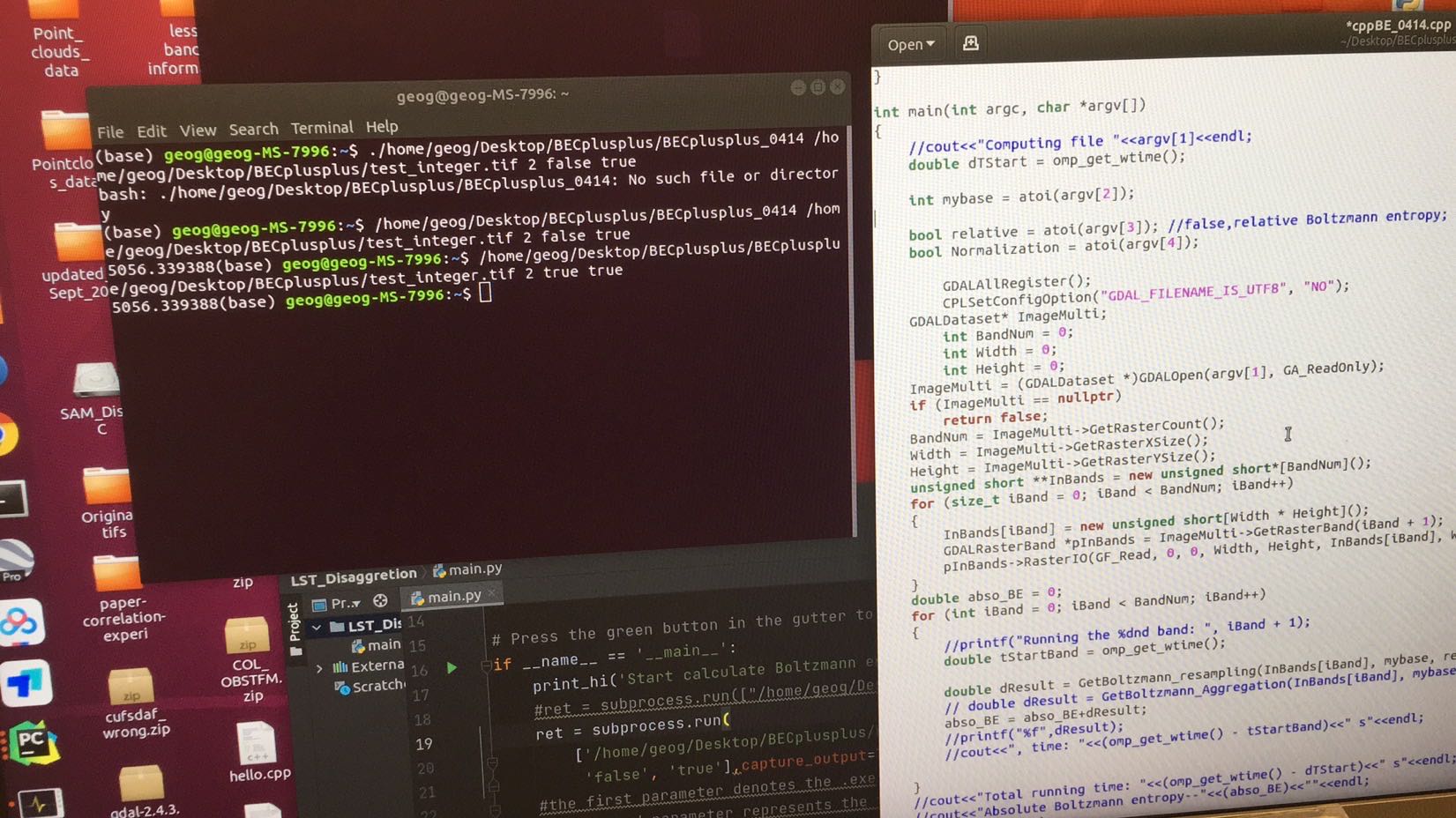
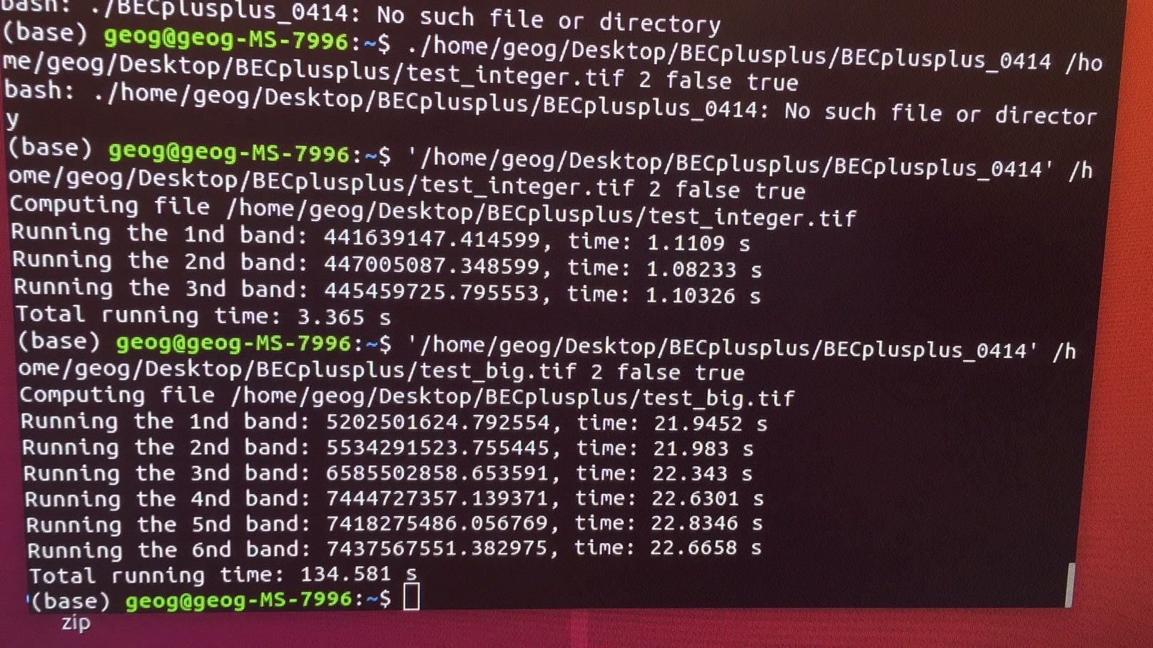
I have devloped a C++-based package (Right click to the see enlarged pictures) for calculating Boltzmann entropy of multisepctral imagery. The package can be used via either Python or C++. The codes can be downloaded by clicking here
Graduate Research
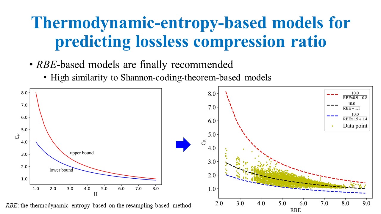
Predicting Loessless Compression ratio of Remote Sensing Images with Boltzmann Entropy
Advisors: Prof. Zhi-lin Li
Scientific Question: How to predict the upper and lower bounds of a remote sensing image at the first hand?
Hypothesis: the lossless compression ratio is closely related to the amount of structural information.
This research project has been converted into my MS thesis. With the excellent research results, I become the first MS student who receive an A+ from Dr.Li, though he has worked in The Hong Kong Polytechnic University for around 24 years.
Most state-of-the-art compression techniques utilize configurational information of images to achieve a higher and higher comression ratio. We use configurational entropy as a configurational information measure to build new models for predicting lossless compression ratio
For more details about the research results, please go to IEEE JSTARS
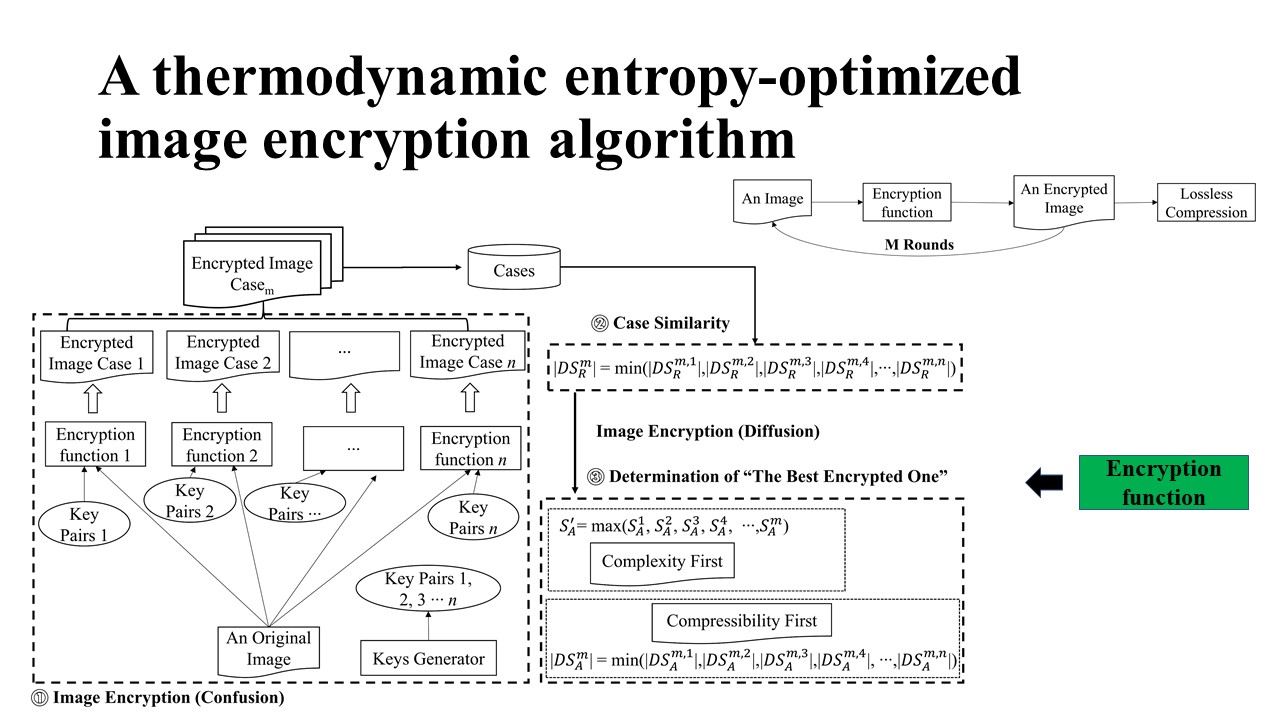
Configurational Entropy for Optimizing the Encryption of Digital Elevation Model Based on Chaos System and Linear Prediction
This paper was accepted by a special issue origanized by Dr.Jian-bo Gao at Beijing Normal University in 2020. Dr. Gao is one of references for my academic applications.
Thermodynamic entropy was employed to optimize the encryption of a DEM (i.e. a grayscale image)
An Information-Theoretic Method for Evaluating Lossless Compression Techniques Applied to Remotely Sensed Data
Advisors: Prof. Zhi-lin Li
I am preparing a research article
Using Boltzmann Entropy to Measure Scrambling Degree of Grayscale Images
Advisors: Prof. Zhi-lin Li
I submitted a paper to a conference, which can be seen here
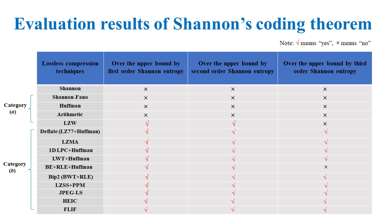
How Does Shannon’s source coding theorem Fare in prediction of image compression ratio with current algorithms?
Advisors: Prof. Zhi-lin Li
The research results have been conveted into a paper, which can be found in the archive of ISPRS Congress 2020
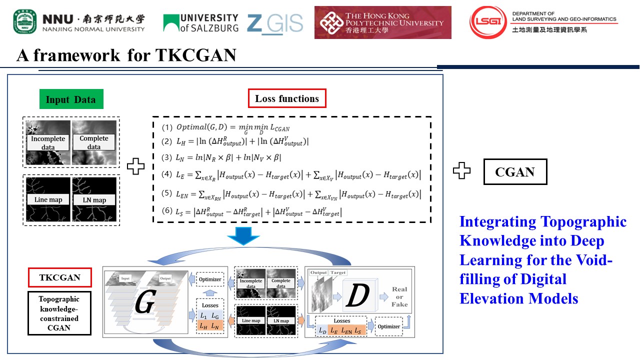
Collaborative Project-Integrating Topographic Knowledge into Deep Learning for the Void-filling of Digital Elevation Models
By intergrating topographic knowledge into CGAN, we reconsturcted the Digital Elevation Model with the improvement on the Ridge and Valley.
Collaborators:Sijin Li, Guanghui Hu,Liyang Xiong,Guoan Tang,Josef Strol
check out our research article publised in Remote Sensing of Environment here.
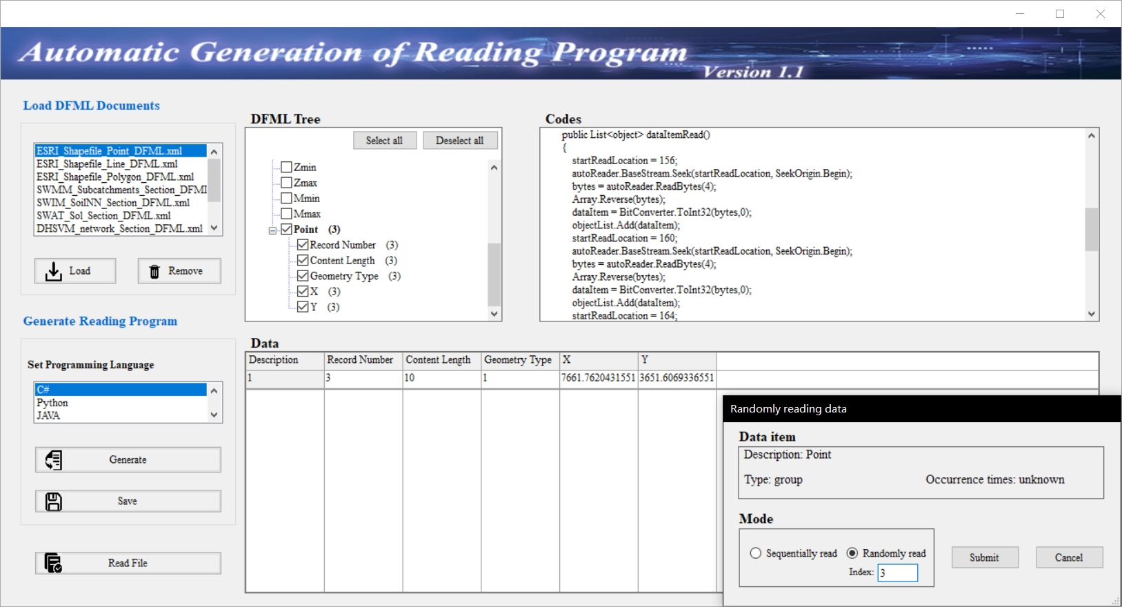
Undegraduate Research-Integrating Structural Description of Data Format Information into Programming to Auto-generate File Reading Programs
Advisor: Dr.Di Hu at Nanjing Normal University, China
With: Mr.Er-jie Hu
The goal of this project was to automatically generate file reading programs.
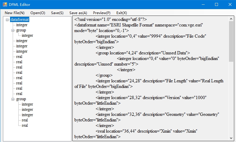
With the structural description of a file by DFML (Data Format Markup Language), we can automatically generate file reading programs.
A research article has been uploaded to arXiv. Please feel free to check out it here
Undegraduate Research-An Automatic Parsing Approach for Acquiring Data Formats of the Inputs and Outputs of Geographic Models
Advisor: Dr.Di Hu at Nanjing Normal University, China
With: Mr.Er-jie Hu
With the help of DFML (Data Format Markup Language), we can automatically acuquire the data formats of the input and output of geographical models.
A research article has been uploaded to arxiv and you can find it here
Undegraduate Research-The Chinese Family Tree Geographical information system
Advisor: Dr.Di Hu at Nanjing Normal University, China
Di Hu, Xinghua Cheng, Guonian Lv,Yongning Wen,Min Chen, In: Ye, X.Y, Lin, H. eds. Spatial Synthesis: Computational Social Science and Humanities. Switzerland: Springer Nature, pp. 13-17, 2021
A research article can be found here
